Produkte von Kartenwerft


High-quality laminated individual charts of the Schlei from the KARTENWERFT SeeKarten Atlas DE1 German Baltic Sea Coast.The SeeKarten charts are ideal for use on smaller vessels such as dinghies, dinghy cruisers, canoes and fishing boats. They are handy, robust, weatherproof and anti-reflective thanks to the matt lamination. They contain all relevant information for skipper and crew.DIN A3 format, laminated, weatherproof, scale 1:20,000.The sheet with the two SeeKarten DE1.7 | DE1.8 includes Innere Schlei and Mittlere Schlei Südwest, i.e. covers the Schlei from Kleine Breite near Schleswig to Lindaunis.The sheet with the two lake charts DE1.9 | DE1.10 includes the Middle Schlei Northeast and Outer Schlei, i.e. it covers the Schlei from Lindaunis to Schleimünde.


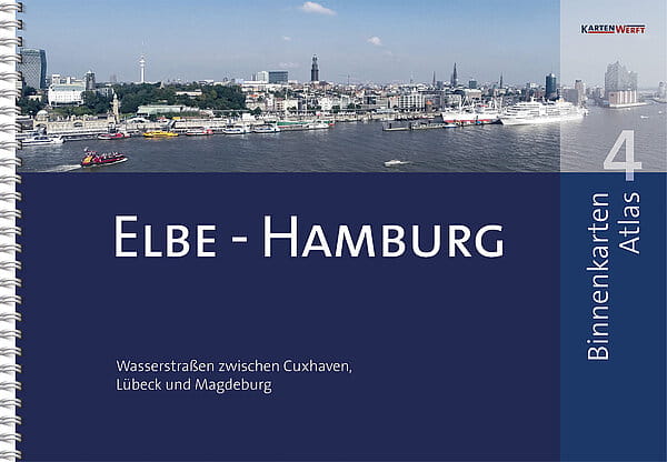
New edition in march 2025.This chart collection of the river Elbe was released by the publisher KARTENWERFT from Flensburg with a special spiral binding.The handy harbour pilot comprises 30 single charts at a scale of 1:40.000 as well as 17 detailed charts (1:10.000 or 1:20.000).Included are the estuaries Cuxhaven-Hamburg-Magdeburg: the lower river Elbe and its tributaries, Hamburger Oberelbe, Alster, Elbe-Lübeck channel and the northern Mittelelbe.Also included is extensive pilotage information and navigational advice besides the graphically very clearly arranged chart material.The digital charts in the KARTENWERFT APP for Apple iOS and Android can be unlocked with the product key supplied free of charge.52 pages, DIN A3 horizontal, spiral binding, soft cover.


Diese ausgewählten Blätter aus den Elbekarten der KARTENWERFT stehen auch als laminierte Einzelkarten zur Verfügung. Die Karten sind ideal für den Einsatz auf kleineren Schiffen wie Jolle, Jollenkreuzer, Paddel- und Angelboot geeignet.Diese vollwertigen Seekarten sind handlich, robust, wetterfest und durch die matte Laminierung effektiv entspiegelt. Sie beinhalten sämtliche relevante Informationen für Skipper und Crew. Format: DIN A3, wasserfest laminiert.Massstab 1:40.000 bzw. 1:10.000/1:20.000.


Nautical chart atlas in handy, ring-bound A3 format.Data from the Federal Maritime and Hydrographic Agency (BSH) and the Danish Geodata Agency (DGA) are presented in an attractive layout for the well-chosen sections of the area. The maps offer a clear structure, catchy symbols, texts in German and Danish and terms and brief information in English.The atlas consists of:5 to 8 area charts (scale 1:240,000)9 to 25 coastal charts (1:120,000 to 1:80,000)37 to 59 detailed charts at a scale of 1:40,000 to 1:20,000The nautical charts can also be used digitally in the Kartenwerft Navgo app (Android and iOS) - free of charge and unlimited.The accompanying port atlas in A4 format presents 74 to 202 ports in aerial photos and port maps (1:5,000 - 1:6,000).As an area service, updates of the area information and reports are available during the season.The charts are protected from splash water in the transparent plastic cover.The chart atlas is published annually before the start of the season, updated up to and including issue 8 of "Nachrichten für Seefahrer".Three chart atlases each are combined in the chart boxes Western Baltic Sea North (DK1, DK2, DK3) and Western Baltic Sea South (DE1, DK1, DK2).


Three nautical chart atlases in handy, ring-bound A3 format are combined in the nautical chart boxes Western Baltic Sea North (DK1, DK2, DK3) and Western Baltic Sea South (DE1, DK1, DK2).Data from the Federal Maritime and Hydrographic Agency (BSH), the Danish Geodata Agency (DGA) and the Swedish Maritime Administration (SMA) are presented in an attractive layout for the well-chosen area sections of the atlases. The charts offer a clear structure, catchy symbols, texts in German and Danish and terms and brief information in English.The SeaChart Box Western Baltic Sea North consists of:the atlases DK1, DK2 and DK3, which cover the area between Anholt, Kiel and Bornholm19 area charts at a scale of 1:360,000 to 1:240,00056 coastal charts at a scale of 1:120,000 to 1:80,000124 detailed charts at a scale of 1:40,000 to 1:20,000The SeaChart Box Western Baltic Sea South consists ofthe atlases DK1, DK2 and DE1, which cover the area between Thyborøn (Limfjord), Skagen, Flensburg and Bornholm19 area charts at a scale of 1:360,000 to 1:240,00062 coastal charts at a scale of 1:120,000 to 1:80,000146 detailed charts at a scale of 1:40,000 to 1:20,000The nautical charts can also be used digitally in the Kartenwerft Navgo app (Android and iOS) - free of charge and unlimited.The three enclosed port atlases in A4 format present around 500 ports in the North box and 373 ports in the South box in aerial photos and port maps (1:7,500 - 1:5,000).As an area service, updates of the area information and reports are available during the season.The charts are protected from splash water in the transparent plastic cover.The chart atlas is published annually before the start of the season, updated up to and including issue 8 of "Nachrichten für Seefahrer".


Inland chart atlas in handy, ring-bound A3 format.Professional cartography in an attractive layout. Easy to use thanks to the clear structure, catchy symbols and north-facing orientation of all charts. Comprehensive textual and pictorial presentation of the respective district sections. The transparent cover protects the maps from splashing water. The atlas consists of:Area overview and planning map for uncomplicated trip planning40 to 56 pages of content26 to 34 map pages26 to 40 inland charts (scale 1:40,000)0 to 2 inland charts (scale 1:80,000)2 to 29 detailed charts (scale 1:27,500 to 1:20,000)The BinnenKarten Atlas is published in new editions at irregular intervals of two to five years. Please refer to the table for the current year of publication.The BinnenKarten Digital for the KARTENWERFT NAVGO app (for Android and iOS) can be used indefinitely. They are continuously updated and are up to date when installed.Thanks to the free RevierService, they remain up to date for one year from initial installation. The RevierService consists of updates to the maps, area information and reports.