AIS stands for "Automatic Identification System" - the marine tracking system is intended to identify vessels and to track and monitor vessel movements. The participants send out ship data like ship name, ship type, call sign and MMSI number (Maritime Mobile Service Identity) at certain intervals. Based on the MMSI number a vessel can be called directly via VHF marine radio. This is useful, for example, if evasive action needs to be communicated. An AIS transponder also provides voyage-related data such as port of destination, time of arrival, draught and cargo category. Each GPS transponder has a VHF radio antenna connection and a GPS antenna. The GPS provides course and speed data, which is sent by all participating vessels. In this way, the AIS device enables a dynamic display of the traffic situation. According to SOLAS, AIS Class A transponders are mandatory for ships with carriage requirements. Class B AIS transponders have established themselves especially on yachts, pleasure boats or smaller fishing vessels.
AIS transponder & receiver


With Generation 2 of the easyTRX3S, the further development of the easyTRX3 AIS Class B transponder with SOTDMA technology and 5 watt transmission power continues. WiFi and ME SENSE Relay for smart boat monitoring are standard features of the transponder.With the standard WiFi module, all received AIS data can be forwarded to a wirelessly connected end device such as a tablet or smartphone. Of course, a connection to the chart plotter via NMEA network is also possible. Thanks to its Bluetooth functionality, the easyTRX3S can also serve as the heart of the ME SENSE yacht monitoring system. The data from up to 20 sensors and 10 actuators are transmitted to the relay via Bluetooth. From there, it is transmitted to the ME SENSE app via the marina's Wi-Fi network or your own LTE router. This allows the yacht itself to be monitored conveniently from home.SOTDMA technologyBased on AIS Class B SOTDMA (Self Organized Time Division Multiple Access) technology, the easyTRX3S transmits with higher (5 watts) transmission power and priority. The transmission slots for the next four transmissions are reserved automatically. Even in areas with high traffic volumes, the easyTRX3S is always able to transmit position reports, as SOTDMA has priority over regular AIS class B devices with CSTDMA (Carrier Sense Time Division Multiple Access). The higher transmission rate improves the visibility of your own AIS position reports on AIS-capable systems.Integrated GPS antenna and active VHF antenna splitterThe integrated GPS antenna increases the independence of mounting the easyTRX3S device on board. On GRP and wooden yachts, only a power connection and a VHF connection are required. On steel yachts, the external GPS antenna available as an accessory improves reception. The integrated, active VHF antenna splitter ensures that the same antenna can be used for VHF radio and AIS. The preamplifier reduces the physical loss to a minimum.FeaturesInternationally certified AIS Class B transponderSOTDMA (time slot method) technology with 5 watts of radiated transmission powerFaster transmission intervals (depending on the speed of the vessel)Complies with the new international standard IEC62287-2CPA alarm & anchor alarmInternal memory for recording travel data (black box)Configuration of the device with USB power supply possibleInternal data memory can be read out with USB power supplyIntegrated WiFiIntegrated antenna splitterIntegrated GPS antennaConnections: NMEA2000, NMEA0183 and USBWater-, weather-, shock- and vibration-resistant, handy housingIoT ME SENSE yacht monitoringAlternatively available with additional LAN or DVB-T/FM radio moduleTechnical data1 channel VHF transmitter2-channel VHF receiver (AIS frequencies: 161.975 MHz and 162.025 MHz)72-channel GNSS/GPS receiverChannel sensitivity: ≤ -112 dBmProtection class: IP67 (dust and waterproof against temporary submersion)Intended for installation below deckOperating temperature: -10°C to + 55°CNMEA output message: VDMTransmission power: 5 WOperating voltage: 9 - 32 voltsDimensions (L/W/H): 190 x 135 x 60 mmWeight: approx. 700 gScope of deliveryeasyTRX3S Generation 2 transponder10-pin connection cable (approx. 2 m)Connection cable to the VHF walkie-talkie (approx. 1 m)USB connection cable (approx. 1.8 m)Quick guide (the detailed user manual can be downloaded from the internal memory)Programming software for Windows PC and Apple Mac on internal memory2x WiFi antennasApprovalsApproved by BSHAIS according to IEC 62287-2:2017Environment according to IEC 60945:2002GPS according to IEC 61108-2003 and EN 301843-1:2004Product safety according to EN 60950-1 ITU-R M.1371-5


The WEATHERDOCK antenna provides raw GPS data.The antenna dome is connected via a six-meter-long cable (extendable up to 15 meters with RG213/U cable) with a TNC connector to a Class B AIS transceiver or transponder (e.g., easyTRX3).These devices require raw GPS data accurate to within 1/1000 of a second. An active antenna, for example when connected to a chartplotter, transmits data via NMEA that is only accurate to within a maximum of 1/10 of a second.Technical SpecificationsDimensions (H x Ø): 13 x 9 cm (antenna without base)Cable length: 6 mConnector: BNC (male)Operating frequency: 1575.42 MHzDirectional characteristics, typical values: Zenith: +5 dBi, 10°: -1 dBiGain: approx. 27 dBAttenuation: max. 2 dBOperating voltage: 5 V DC (+/- 10%)Operating current: < 30 mAVSWR: max. 2:1Package ContentsGPS antennaPlastic mounting base for screw-on installation. Alternatively, any other mounting option with a 1" x 14TPI thread can be used (see "Accessories & spare parts").


The ICOM M605EURO is the most modern VHF built-in radio from ICOM. It has a completely new design and many new functions, has a very clear 4.3 inch LC colour display and can also be controlled intuitively via the generous user interface with soft keys and function keys below the display.With GNSS receiver (location determination also via alternative satellite systems to GPS, e.g. GLONASS, GALILEO), AIS receiver, background noise cancellation (ANC) and 30 watt amplifier for use as an intercom system.Features:4.3" colour TFT displayIntegrated AIS receiverActive noise cancellationTwo- & three-channel monitoringSupport of the new 4-digit channelsLast call voice recording for up to two minutesIntegrated GPS receiver and external antenna30W megaphone with foghorn functionNMEA 2000 & NMEA 0183Waterproof to IP X8You can enter the MMSI and ATIS identifier yourself (once). Correction of the MMSI and/or ATIS number, e.g. after a change of owner, can only be carried out by a service technician (for a fee).The activation of additional VHF marine radio channels (e.g. channel 31 for use in the Netherlands) can be carried out for a fee.Up to three optional COMMANDMIC HM-229 (article no. 3938-229) can be connected. However, these cannot be used to make a DSC emergency call. The COMMANDMIC is not included in the scope of delivery.The VHF marine radio is also compatible with the ICOM navigation system (MarineCommander). Please ask us about this.You can find more technical details in the operating instructions (Bedienungsanleitung) as a pdf file further down on this page under "Downloads & Information".

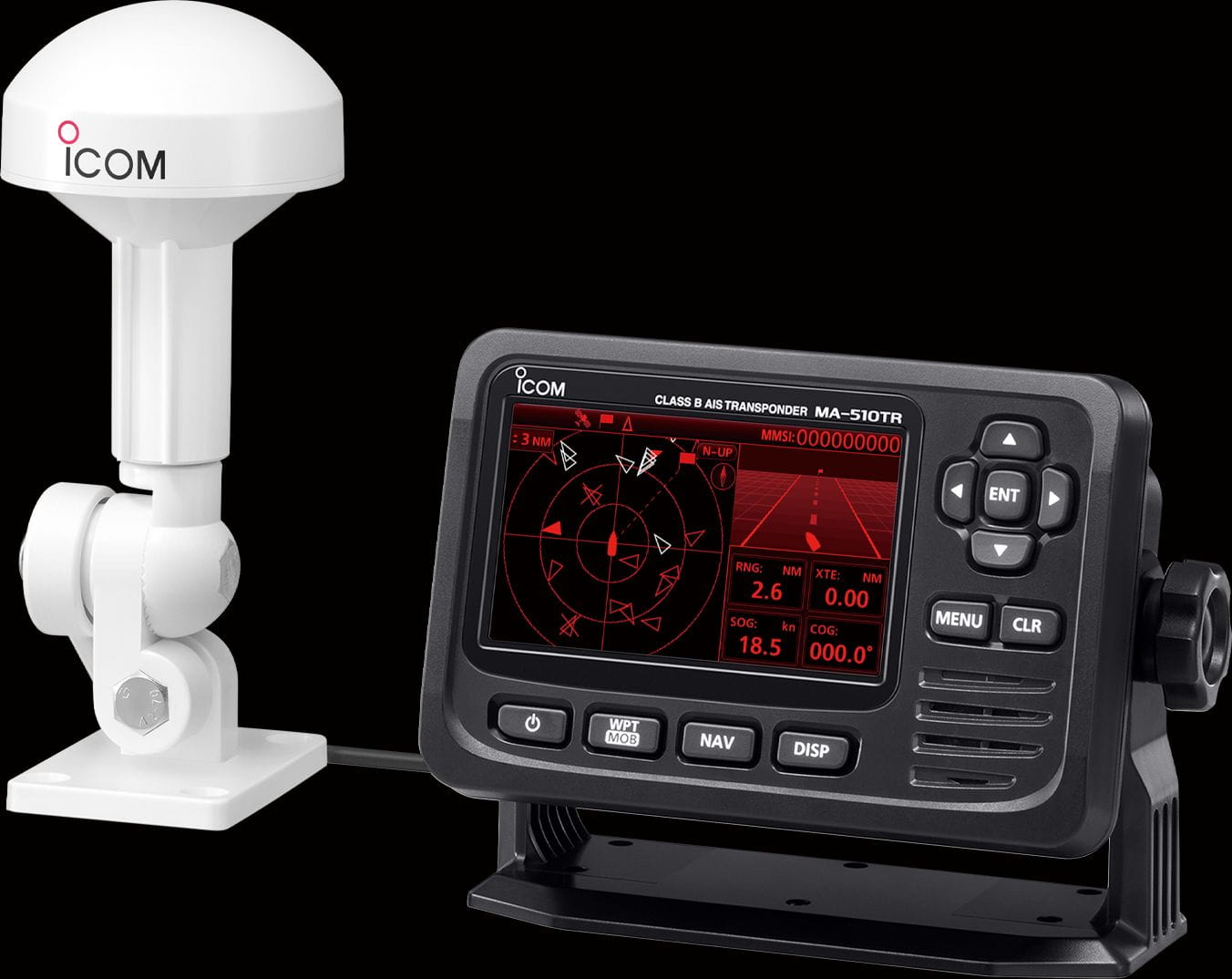
An AIS transponder on your ship automatically receives information from other ships equipped with AIS or from coastal stations and transmits data about the movement and other information about your own ship. AIS-equipped vessels and buoys are displayed even if they are difficult to detect with a ship's radar. The MA-510TR can receive both Class A and Class B AIS signals, increasing your safety at sea.4.3-inch Color TFT LCDThe wide viewing, high resolution 4.3-inch color TFT display clearly shows your and other vessels’ positions. The day-mode display is readable in direct sunlight, and the night-mode display ensures good readability in the dark for further convenience.AIS Target List and Details The ‘Target’ list screen shows all detected AIS equipped vessels and targets. The ‘Danger’ list screen shows a list of vessels that are within six nautical miles of Closest Point of Approach (CPA) and sixty minutes of Time to Closest Point of Approach (TCPA) from your vessel. The ‘Friend’ list screen displays the detected AIS targets that you set as friends.Simplified Navigation Function The Navigation function guides you to a specified waypoint or AIS target. You can assign a maximum of 100 favorite fishing spots or destinations as waypoints. The Navigation function is simply started by just selecting a waypoint or an AIS target on the display. A navigation to a MOB-Waypoint is also possible.Individual DSC Call An individual DSC call can be sent by selecting an AIS target and voice channel on the MA-510TR. A compatible marine VHF radio is required for this function.USB ConnectivityAIS-Daten können über die USB-Schnittstelle auf der Rückseite des Transponders ausgegeben werden.Supplied GPS AntennaThe GPS receiver with SBAS function is integrated in the MA-510TR.NMEA 2000, NMEA 0183/-HS ConnectivityThrough the NMEA2000, NMEA0183 and USB interface, the AIS data can be passed to external chart plotters, marine radars, radios or other devices.. Collision Alarm FunctionWhen a vessel comes into the CPA or TCPA range, the vessel’s icon blinks on the plotter display and a beep sound is heard.Silent-ModeFor privacy and security, the transmission of the own ship's position data by the AIS transmitter can be temporarily switched off.Other FeaturesCompatible with both 12 V and 24 V power sourcesAnchor watch function sounds an alarm when your vessel is at anchor but has driftedIPX7 waterproof protection (up to 1 m depth of water for 30 minutes; except connectors)You can find more technical details in the operating instructions (Bedienungsanleitung) as a pdf file further down on this page under "Downloads & Information".


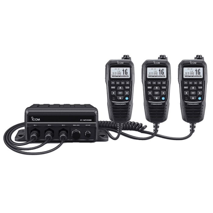
The IC-M510BB is a black box VHF marine radio with a remotely mountable control unit as the sole call station.The waterproof (IPX7) HF unit IC-M510BB can be installed in a place where it will not interfere. All functions, including DSC operation, can be operated with the supplied COMMANDMIC HM-195GB. Its cable length of 6.10 metres can be extended to a maximum of 18.30 metres. Two optional OPC-1541 extensions are required for this. You will find these (Article-No. 3938-154) further down on this page under "Accessories" for the COMMANDMIC.Install up to three stations on board, VHF radio available at your desired positions Up to three COMMANDMIC control units can be connected to the IC-M410BB, providing access to the VHF radio and the intercom functions. When using the intercom function, you can choose between a single call or an all-call. It is possible to transmit from up to three different positions on board. NMEA 2000 and NMEA 0183-HS enable data integration on board. The NMEA 2000 network provides plug-and-play data communication for connection to other marine devices, such as an MFD (multi-function display). The radio can send GNSS (GPS) position, DSC call, AIS signals and radio channel to other devices.The integrated AIS receiver monitors the movements of other vesselsThe integrated AIS receiver shows you ships in the immediate vicinity. You can set an alarm for "too close" approaches to avoid collisions. As the MMSI is part of the AIS data received, you can address a selected vessel directly via an individual DSC call.DSC remote control interface for PC console software (EN 300 338-8 compliant) The IC-M510BB has a special DSC remote control port (compatible with EN 300 338-8) that enables connection to PC console software or an external device. This allows you to centralise the control of emergency communication.Two-minute voice recording function for replaying the last call The voice recording function for the last call automatically saves up to two minutes of an incoming call. So you won't miss any more messages.Active noise cancellation - no need to shout into your microphoneActive noise cancellation digitally removes background noise from both the transmit and receive audio, ensuring clear communication even in noisy, maritime environments.Built-in Class D DSC, "Distress" button can be a lifesaver in an emergency situation With just one press of the "DISTRESS" button, the inbuilt DSC (Digital Selective Calling) system can digitally transmit distress information to the coastguard and/or other vessels. The DSC monitoring function continuously monitors the DSC channel (channel 70) for added safety and protection.Loud one-way receiver loudspeaker megaphone for radio watch on deck or tower A built-in 13-watt amplifier increases the audio output to an external call loudspeaker. The 1-way RX hailer function allows you to monitor radio traffic on deck via the loudspeaker megaphone. You can also play foghorn patterns via the loudspeaker megaphone.Built-in GPS receiverThe built-in GPS receiver displays your current position, date/time and can be used for DSC calls. The GPS antenna supplied eliminates the need for time-consuming connection to other GPS data sources and allows you to flexibly select the location for a good reception signal.Features:NMEA-2000 and NMEA-0183-HS connectivityAquaQuake training function (HM-195B)For 12 volt power supplyWaterproof according to IPX7 (30 minutes at a depth of 1 m)Dual/triple channel guard for simultaneous monitoring of channel 16 and/or call channelAnchor watch functionAs the user, you can enter your MMSI into the device yourself after switching on the transceiver (once, in accordance with applicable regulations)Additional programming with an ATIS ID is possible after prior activation of this area by the dealer. Please ask us about this.Scope of deliveryHF unit IC-M510BB with integrated GPS and AIS receiverOne CommandMic HM-195GB with connection cable OPC-1540 (6.1 m)GPS antennaPower supply cable (DC cable 2 m)Microphone suspensionConnection capMounting bracketYou can find more technical details in the operating instructions (Bedienungsanleitung) as a pdf file further down on this page under "Downloads & Information".


The Ocean Signal AIS Alarm ensures that any AIS MOB or AIS SART activation immediately triggers an 87 dB audible alarm.Thanks to its simple design, compact housing and NMEA-0183 connection, the AIS Alarm can be quickly connected to an existing NMEA-0183 network or to an AIS receiver.Up to 30 device IDs of AIS SARTs (974ff) or AIS MOBs (972ff) can be stored (USB cable, free software). This allows an alarm to be assigned precisely. The internal relay allows the AIS alarm to be connected to an external siren or to the ignition of the engine for automatic shutdown.The AIS Alarm from Ocean Signal is waterproof and can be installed outdoors. The power supply is 12 V (10.8 V - 15.6 V DC).Flush or bracket mountingWaterproof (for outdoor installation)Programmable with up to 30 individual device IDsNMEA-0183 input (38,400 baud)Power and USB cable includedProgramming software available online free of chargeRecognizes AIS SART and AIS MOB devicesDifferent tones for recognizing the stored devicesAlarms for all received or specific targetsNMEA input and output (pass-through port) for easy integration into the network


The AIS & GPS combination antenna from WEATHERDOCK combines the reception of AIS and GPS/GLONASS/Galileo signals in a compact, robust design. The dust and waterproof antenna (IP67) is supplied with a screw-on mounting base (for screw, mast or adhesive mounting). Alternatively, any other mounting option with a 1" x 14TPI thread can be used (see ´Accessories´).The combination antenna is ideal for use with the easyTRX3S AIS transponder (Class B), but can of course also be connected to transceivers from other manufacturers.Technical featuresDimensions (L x W x H): 248 x 110 x 74 mmGPS connection (blue): BNCAIS connection (white): PL259Cable length 10 metres each


AIS receiver and transmitter with integrated antenna splitter in accordance with the modern SOTDMA Class B standard. The latter's higher transmission power and signal priority ensure that the position of yachts is displayed more reliably on the devices used by commercial shipping and other yachts. The AIS information on ships, courses, speed and possible close approaches or collision courses are displayed in the plotter, making it easier to keep track in busy areas or when sailing at night - see and be seen.Thanks to the built-in antenna splitter, the AIS700 can be easily connected to the existing VHF antenna and fits into any NMEA 2000 network and, thanks to the additional 0183 output, also into older NMEA networks.The scope of delivery also includes its own external GPS antenna. The initial programming of your own MMSI and other ship data can be carried out conveniently using the supplied Raymarine ProAIS2 software with a PC via a USB interface.SOTDMA technologyBased on the AIS Class B SOTDMA (Self Organized Time Division Multiple Access) technology, the AIS700 transmits with higher (5 watts) transmission power and priority. The transmission slots for the next four transmissions are reserved automatically. Even in areas with high traffic volumes, the device is always able to transmit position reports, as SOTDMA has priority over regular AIS Class B devices with CSTDMA (Carrier Sense Time Division Multiple Access). The higher transmission rate improves the visibility of your own AIS position reports on AIS-capable systems.Technical specificationsDimensions: Height 132.55 mm, width 171.65 mm, depth: 57 mmWater resistance: IPX6, IPX7Power supply: 9.6 to 31.2 V DCPower consumption: 3 WNMEA2000 connection: Device-Net connector and 0183 as well as PC/USB connectionsVHF antenna connection/radio connection: SO-239 coaxialGNSS antenna connection: 50 Ω TNC coaxialAIS: CLASS B transceiver,AIS power: 5 W SOTDMAGPS: GPS, GLONASSUSB connection: Micro-BScope of deliveryaIS700GNSS antennaPower/data cable, 2 m (6.56 feet)VHF radio cable, 1 m (3.28 feet)deviceNet-SeaTalkng ® adapter cable, 1 m (3.28 feet)GNSS antenna gasketGNSS antenna, pole mountFixings (4 self-tapping screws, no. 8x19)M5 nut and washer (grounded)documentationGNSS antenna fixings (3 M3x40 bolts with wing nuts)Software CD


Das AIS4000 ist ein zertifizierter Klasse-A Transceiver für die Berufsschiffahrt oder größere Yachten und Traditionsschiffe. Er empfängt die AIS-Daten des Verkehrs in der Nähe und sendet ihre Schiffskennung und Bewegungsdaten an diesen. Kann mit einem 5-Zoll-Bildschirm als Stand-Alone-Gerät genutzt werden oder im Verbund mit der Bordelektronik durch NMEA 2000 und 0183-Kompatibilität. Eine Anschlussdose für erweiterte Schiffssensor- und ECDIS-Konnektivität ist ebenfalls inbegriffen. Der AIS4000 ist nach SOLAS und für die Binnenschiffahrt zertifiziert. Die Verbindung kann via Kabel oder eingebauten WLAN erfolgen.Das AIS der 4. Generation ist auch für höhere Boots-Geschwindigkeiten geeignet, und verarbeitet die Daten der anderen Schiffe noch schneller. Es verfügt über ein hochauflösendes Farbdisplay für schnellen Zugriff auf optional integrierte Karten, Alarm und Nachverfolgung. Zum Funktionsumfang gehört auch ein integriertes MOB/PLB-Warn- und Verfolgungssystem und natürlich die üblichen Daten und Warnmeldungen für CPA (Closest point of Approch/dichteste Annäherung) und TCPA (Time to closest approach, verbleibende Zeit bis zur Annäherung). Eine externe GPS-Antenne gehört zum Lieferumfang.Das Gerät ist vom Käufer unkompliziert selbst auf die eigenen Schiffsdaten inklusive MMSI programmierbar. Lieferumfang: AIS-Sender/Empfänger, Montagehalterung, Produkthandbuch, Befestigungen, STng-zu-DeviceNet-Kabel (NMEA2000), Garantiekarte, Montageschablone, Kurzanleitung, Widerstandspaket, Spannungskabel, 14-Wege-Datenkabel, 18-Wege-Datenkabel, GNSS-Antenne mit Anschlusskabel.Technische Daten5 Zoll-LCD-Display, 800 × 480 Abmessungen: 152mm x 165mm x 70 mmGewicht: 1 kgBetriebsspannung 12/24 VSchutzklasse: IPX6 und IPX 7Anschlüsse: UKW-Antenne, GNSS, 2-poliger Stromanschluss, serielle Schnittstelle 18-poliger Stecker, Serieller Eingang 14 polig, NMEA-2000 Mikro, Mikro-SD Steckplatz für Software Updates und DatenUKW-Transceiver: 1 Sender, 3 Empfänger.Frequenz: 156,025-162,025 MHzSendeleistung: 1 W oder 12,5 W (automatisch)Kanalbandbreite 25 kHzGNSS-Transceiver: 72 Kanäle, GPS und GLONASS